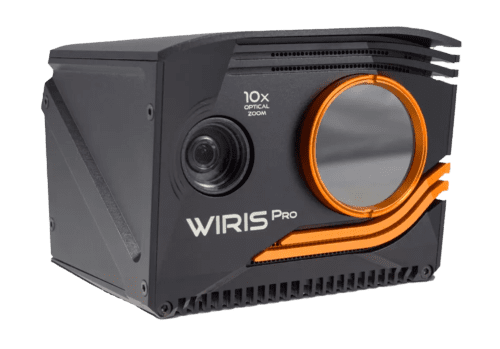


WIRIS Pro
RADIOMETRIC INSPECTION THERMAL CAMERA
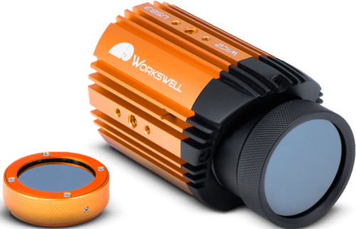
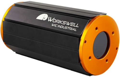
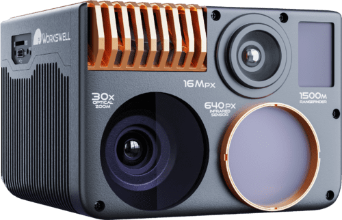
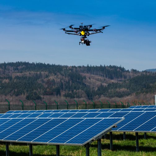
The Workswell WIRIS Pro is a fully radiometric thermal camera that has been specially designed for use with unmanned aerial vehicles (UAVs), or drones. The WIRIS Pro is at the forefront of a new generation of thermal cameras built for the most demanding applications, including industrial inspections, archaeology, and precision agriculture.

The Workswell WIRIS Pro is a specially designed thermodiagnostic device. Its thermal camera is equipped with an LWIR microbolometric sensor with 640×512 px resolution (in the 7.5 – 13.5 μm range), and its ‘Super Resolution Mode’ functionality can deliver a final thermogram in 1266×1010 px resolution. The RGB camera comes with Full HD (1920 x 1080 px) resolution and provides an absolutely unrivalled optical ultrazoom 10x in real-time (6.9° to 58.2° field of vision). The highest possible temperature that the thermal camera can measure is 1,500 °C (2 732 °F).
Temperature Range
-25 °C to +1500 °C
Sensitivity
0.05 °C
Memory Capacity
128 or 256 GB SSD
10x Optical Zoom
with stabilization.
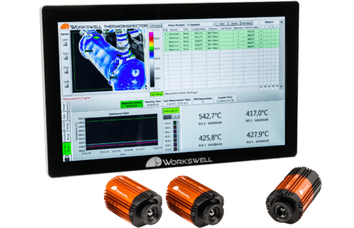
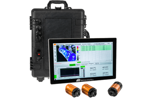
Real-Time Data Analysis
immediate processing and interpretation.
Master Every Inspection Challenge.
Master your vision with WIRIS Pro
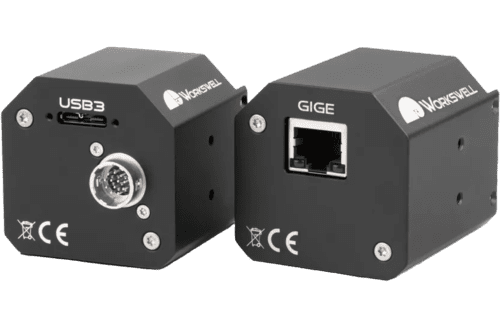
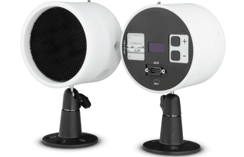
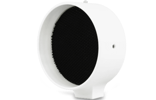
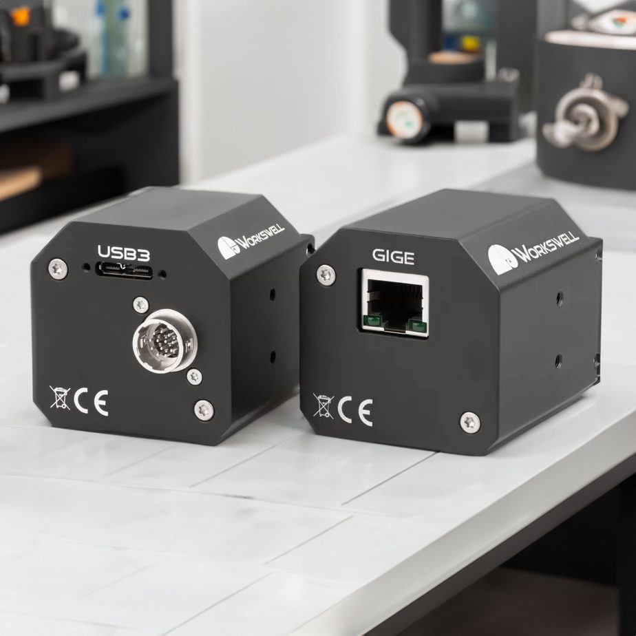
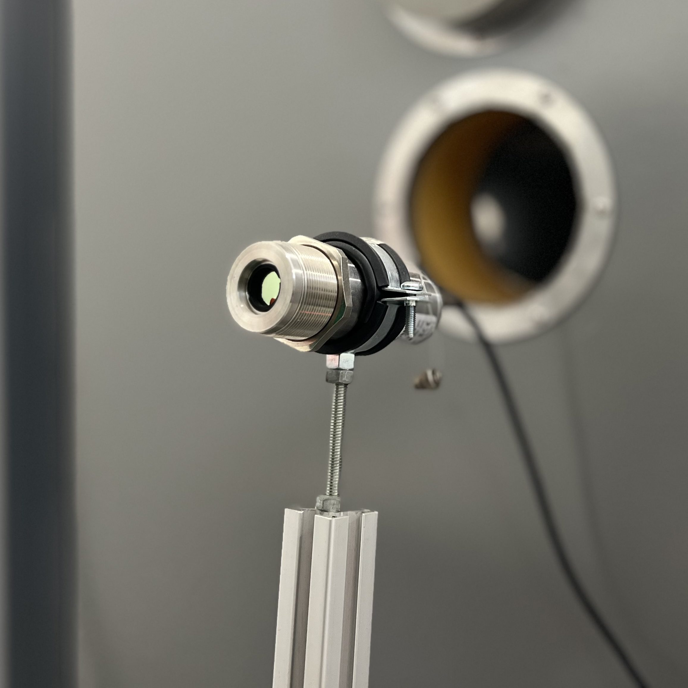
Product photos


Connectivity
& interfaces

Ethernet

HDMI

USB 3.0

Micro USB

S.Bus & CAN protocol

UART

MavLink

Digital trigger input
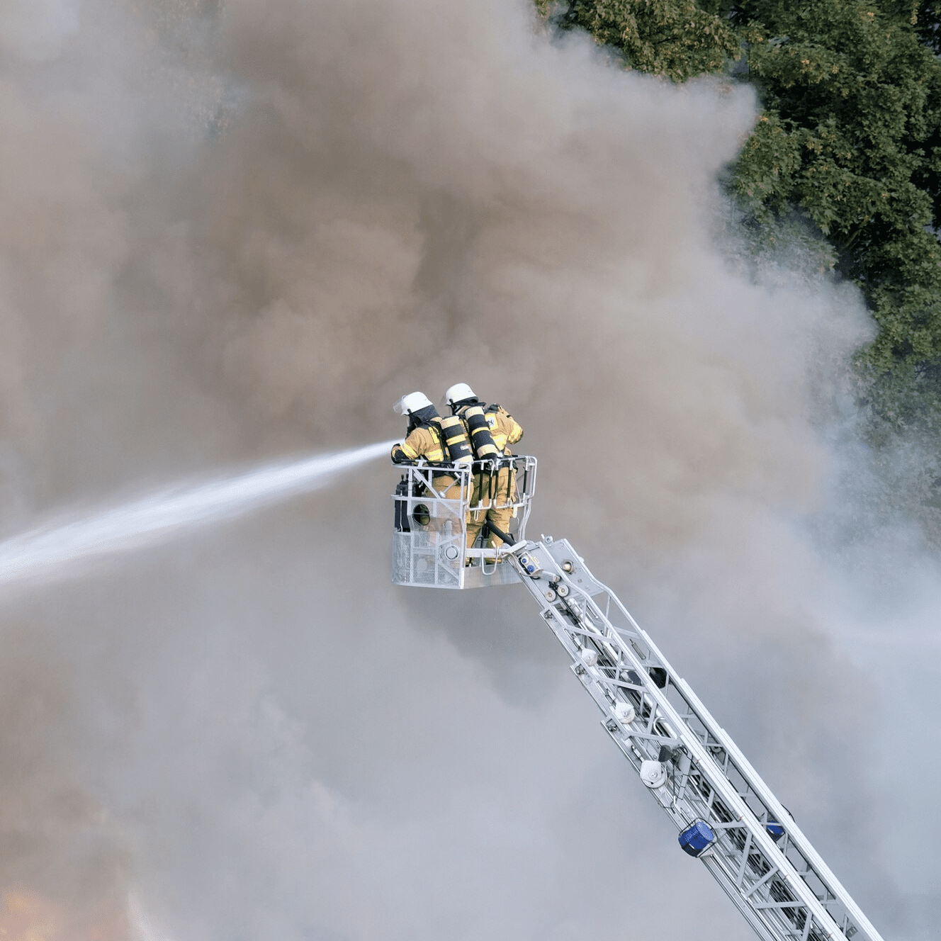
Applications
Thermal and infrared imaging technologies, embodied in devices like thermal cameras and infrared cameras, have transformed several industries.. Their integration into UAVs as payloads, extends their capabilities. These tools are now essential in environmental monitoring, industrial inspections, and safety operations. Drones equipped with radiometric thermal cameras offer detailed, quantitative temperature analysis, crucial in applications like infrastructure inspection and environmental assessments.


Software
At Workswell, we offer more than just state-of-the-art thermal cameras; we provide a suite of sophisticated software solutions designed to maximize the potential of your thermographic equipment.
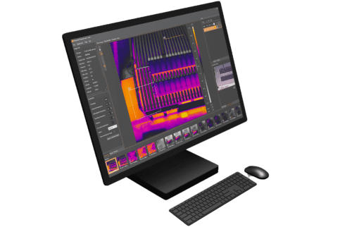
Thermolab is a software tool for detailed thermogram analysis, offering standard data analysis functions and extended features like GPS image location and displaying digital RGB images.
An advanced operating system for thermal cameras, ensuring full real-time data streaming and control during flights, with easy camera control through various interfaces.
This tutorial likely provides guidance on using the WIRIS Data SDK, a software library for controlling Workswell WIC cameras, adjusting settings, and streaming data.
An interface used for integrating UAV cameras with MAVLINK systems, allowing for advanced control and data transmission capabilities.
This SDK is possibly related to the streaming and control of camera data over Ethernet connections, but specific details are not available.
This software development kit likely aids in integrating WIRIS cameras with systems using CANbus and UART interfaces, allowing for advanced control and data management.
For engineers and technicians
Related documents
For clients
My.Workswell
Explore Key Insights: Studies and Articles
Dive into the essence of innovation with our curated selection of studies and articles on our products. This compilation offers a glimpse into the advanced features, real-world applications, and expert insights surrounding our solutions. Ideal for professionals, researchers, and technology enthusiasts, it provides a concise overview of how our products are making a difference across industries. Engage with concise analyses and discover the impact and potential of our technologies, all in one place. Whether you're familiar with our offerings or exploring them for the first time, this collection is designed to inform, inspire, and intrigue.
WIRIS Pro
- Drone detection with the aid of convolutional neural network
- Aerial Thermography Inspections in Large-Scale PV Plants
- Application of an innovative method (aerial infrared thermography) for the energetic evaluation of existing buildings
- Bezpilotní systémy pro speciální aplikace CZ
- Use of aerial thermography to reduce mortality of roe deer fawns before harvest
- The use of unmanned aerial vehicles (UAVs) for engineering geology applications
- On-site geometric calibration of thermal and optical sensors for UAS photogrammetry
- On-site geometric calibration of RPAS mounted sensors for SfM photogrammetric geomorphological surveys
- Failure diagnosis on photovoltaic modules using thermography, electroluminescence, RGB and I-V techniques
- Infrared Thermography for the Detection and Characterization of Photovoltaic Defects: Comparison between Illumination and Dark Conditions
- Multi-sensor imagery rectification and registration for herbicide testing